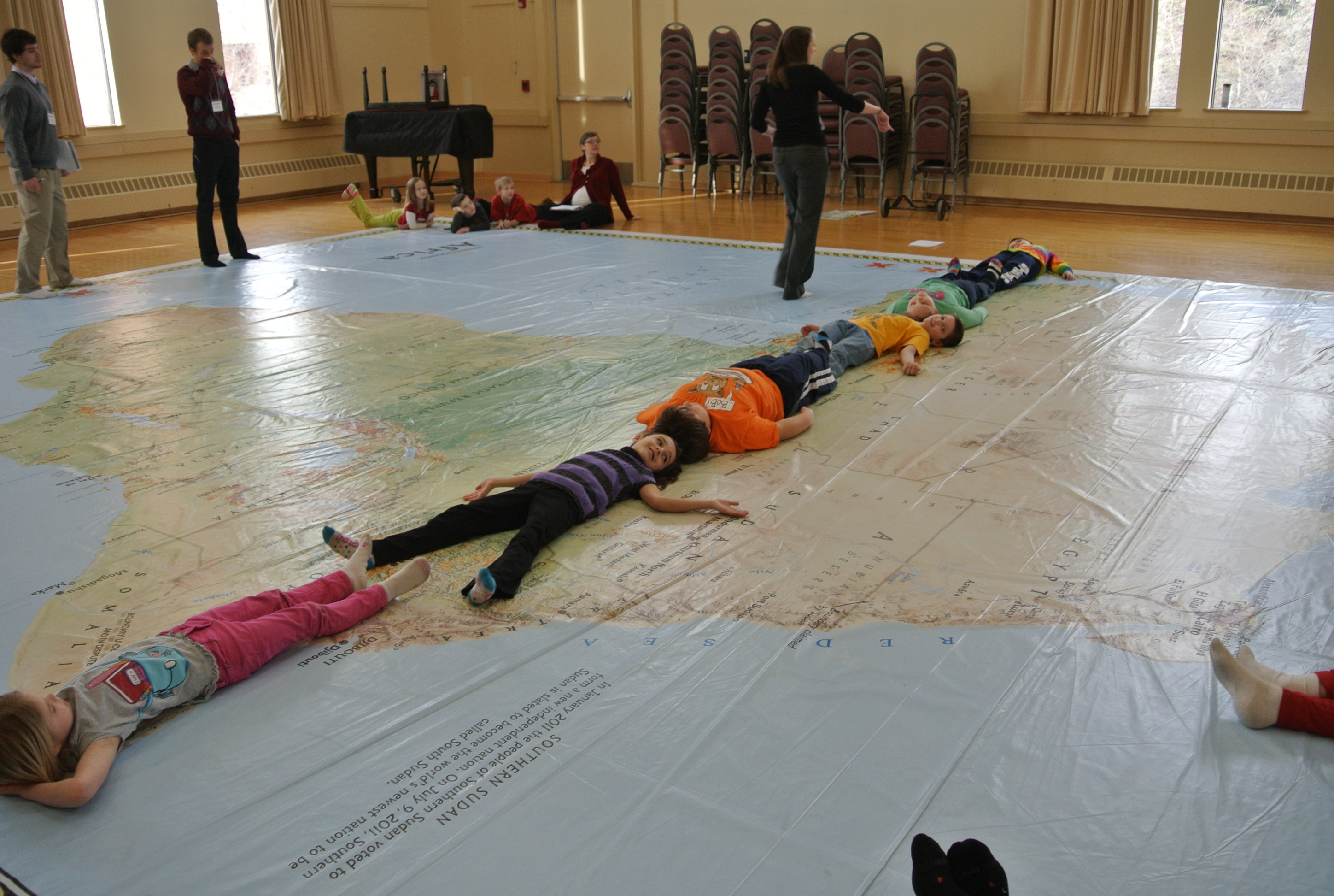
This semester’s elementary Social Studies methods group jumped right into teaching! For our first day of class, we helped second grade students from St. Peter’s South Elementary explore National Geographic’s Giant Map of Africa.
In this activity, we asked students to estimate whether Africa is longer north-south or east-west. Then the second grade students used their bodies to find in the answer!
Here are a few things that our teacher candidates had to say about the experience:
- “I was able to connect with and teach students about Africa. It means a lot when you get the opportunity to put into practice what you are learning in your college classes! Sarah Larson, junior, Elementary Education major
- “Using the Giant map created a learning environment that promoted engagement, physical activity, as well as fun.” Joshua Timmerman, senior, Elementary Education major
- “The map represented one of the many diverse tools that can utilized in a classroom to enhance learning. Using the Giant Map of Africa provided students with a more hands-on experience that they couldn’t experience with a simple map in a classroom.” Brad Kluver, senior, Elementary Education major
We also made the local paper! Click here to read what the St. Peter Herald has to say about the event! (Jill Oxborough and Megan Schroepfer were quoted!)